I have been allocated the topic "The Frontline in Overseas
Field Research", but unfortunately my area of expertise is somewhat
different. I have been involved with the history of Japan, China and
Korea, but as far as overseas research is concerned, I must ask the
assistance of my colleagues abroad and learn from their work. Of course
I have gained much from them, but I have no confidence about my qualifications
to talk on my own behalf. Therefore I would like to speak here of some
recent field research I have undertaken in Japan.
1 The port of Shimizu (Kochi prefecture) and foreign contacts
Three years ago I visited Kochi with a number of colleagues for several
days, and toured the historical sites there. Kochi has not drawn
much attention from the point of view of foreign contacts, but during
the Sengoku period (particularly the sixteenth century), a route
linking Sakai, Kochi, the Pacific Ocean, Kagoshima, the Goto Archipelago
and Ningbo in China was opened up, in addition to the established
route of Kobe, the Inland Sea, Hakata, the Goto Archipelago, Ningbo.
This development was the result of a confrontation between the powerful
Hosokawa and Ouchi provincial lords over the dispatching of official
trading ships to China. As a result, Kochi became a transit point
in the Chinese trade. Maritime trade expanded greatly throughout
the world particularly in the sixteenth and seventeenth centuries,
and we find many accounts of people drifting ashore on the Pacific
coast. Kochi too had its fair share. The most famous example is perhaps
the "San Felipe", a Spanish trading ship which ran aground
in Urado Bay (now part of Kochi) in 1596. During the middle ages,
the district of Hata on the western shore of the bay was particularly
important. A map made in China in the sixteenth century makes special
mention of the ports of Nakamura and Shimizu, both part of Hata.
In addition, a document dating from the Edo period (1600-1867) mentions
that in 1574, when Chosokabe Motochika (1539-1599) conquered the
Hata district, he noted the size of the port of Shimizu and commented, "That
is the reason so many great foreign ships come here."
The port of Shimizu is deep and the coastline inward-curving. It
is surrounded by tall hills, which makes it an ideal location for
ships to take shelter.
North of Cape Tomi to the west of Nakahama (the birthplace of John Manjiro
[1827-1898], a young fisherman who was rescued from a wreck by an American
ship and taken to the United States), the bay forms an L-shape to the east.
On a promontory to the north, looking down over Shimizu Bay, is a temple called
Renkoji, affiliated with the Pure Land sect of Buddhism. It was founded in
the fifteenth century, suffered under the Meiji government's policy to separate
Buddhist and Shinto forms of worship, but was later restored. During the middle
ages, most ports were furnished with religious facilities such as temples and
shrines, and Shimizu was no exception. A document from 1480 seeking donations
to build the temple "it faces the sea and [welcomes] travelling merchants,
dividing the winds of profit and welcoming and farewelling seamen from north
and south." This is a clear indication of the function of the temple as
a port-affiliated facility. In the grounds there is a spring, reminding us
that the provision of clean water was a necessary condition for a port servicing
ocean-going ships.
That Renkoji was the center of this district is demonstrated by a
story related to the coming of a Spanish vessel to the port in 1616.
According to a document dating from 1686 recording the memories of
an old woman, this ship was driven ashore by strong winds on the 13th
day of the seventh month. The Spanish thought that the villagers, who
had gathered at the temple that day to perform a memorial rite for
lost souls (segaki), were actually there for the purpose of exorcising
them (the Spanish). The sight of the villagers performing what were
to them disgusting heathen rites probably filled the Spanish with fear
and suspicion. Renkoji also took charge of bodies washed ashore who
were without relatives and held memorial rites for them. There remain
in its precincts even today the graves of sailors from a Ryukyuan ship
which ran aground in 1705 and of fishermen from Wakayama who had been
cast ashore in 1781.
The eastern end of Shimizu is known as Urajiri, and here there are
a number of place names connected with ships - Oikaridani ("Great
Anchor Valley"), Koikaridani ("Small Anchor Valley"),
Funaba ("Landing Stage"), Mikokura ("Old Storehouse")
etc. The names "Oikari" and "Koikarigawa" already
appear in the Chosokabe cadastral records, which tells us these names
date from the medieval period. Of particular interest is the place
name "Tosen-Jima" (Island of the Chinese Ship). Following
an earthquake in 1946, this small island rose eighty centimeters, and
because of its geological importance was designated a natural treasure
by the Japanese government. According to Edo period documents, the
name derives from the fact a Chinese ship sunk here. It is very small,
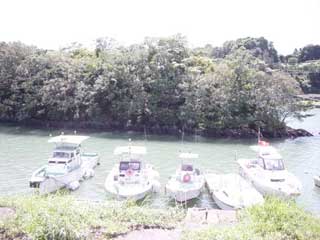
too small for habitation. It lies very close to shore and provides
shelter for boats from the wind. Even today fishing boats use it for
this purpose (see photograph).
It is very likely that the island has provided shelter for ships since ancient times, and it is quite likely that a "Chinese ship" may have sunk here. Of course we cannot accept at face value the Edo period explanation, but it is probable that the tale took root because of the island's role as a mooring for shipping and the memories of local people who had seen foreign ships passing by. The term "Tosen" was applied to any ship engaged in foreign trade, and included Korean and European ships as well as Chinese ones. It could also be used for Japanese ocean-going ships and for Japanese ships carrying foreign goods.
 |
2 Seeking out "Tosen" islands
To change the topic a little, last year I went to Oita in Kyushu to
study sites associated with medieval ports. In the latter half of
the sixteenth century, Oita was under the control of the Otomo lords
and was a prosperous center for overseas trade. Particularly well-known
as a port was Bungo Funai, on the southern shore of Beppu bay, but
Hiji on the northern shore was also a port for arriving Portuguese
ships. (Francis Xavier requested the captain of a Portuguese ship
at Hiji to take him to Oita to meet Lord Otomo Sorin.) West of Hiji,
on the north-western side of Beppu bay, was the port of Toyooka,
known during the Edo period as Kashiranari. In 1694, the Neo-Confucianist
and botanist, Kaibara Ekken (1630-1714), came here and recorded, "Kashiranari
is a place where boats tie up, and large ships also moor here." Early
Meiji statistics tell us that several hundred boats entered the port
annually.
During my study I came across the name "Tojin-Jima" (Island of the Chinese) in a place-name dictionary, said to be in the vicinity. I did not have the time to visit at that point and I did not know precisely where it was. However after I returned from my study trip, I found out that it was a promontory rather than an island, a little to the east of Toyooka, and known today as Shimayama. It is like a small cape, rising to a hill at the end. It too would have provided boats shelter from the wind, and even today boats moor in its lee. An alternative name is Karifune-shima, suggesting boats could find temporary refuge here. There is a shrine here to the kami of sea travel, Kotohira (Konpira) which acts as the symbol of the port. Early modern gazetteers tell us that the name Tojin-Jima derives from the fact that Chinese ships visited here during the Heian period (794-1185). This is doubtless a later logic; the name Tojin-Jima probably took root because the place provided a mooring near the coast and because local people had in the past watched foreign ships arriving there.
It is of great interest that Tojin-Jima in Oita and Tosen-Jima in Shimizu have similar locations and are called by similar names. Wondering whether there were perhaps other islands of the same name, I did a quick search of the dictionaries and maps I had to hand, as well as the Internet, and did discover a number of Tosen Islands (though no Karabito ones). I have not travelled to any of them, or made a close study of them, but would all the same like to introduce them here.
The first is located in Amakusa, Kumamoto prefecture, in the town of Oyano. The Amakusa archipelago is made up of a large number of islands; Oyano island is situated at the entrance to the archipelago coming from the Udo peninsula. It is known that a "Chinese ship" came here in 1545, and it appears to have been a port for trading ships in the sixteenth century. There is an island called Nokama-shima opposite its north-western shore, which has a beach on the northern side called Tosen-ga-hama, now well-known as a place for sea-bathing. Tosen Island lies opposite. Judging from the map, it is about one kilometer from shore, but the area between the island and the beach is mainly shoals, so it is doubtful if it would have been used for mooring as in the case of the Tosen Islands of Kochi and Oita.
The second is off Uchitomi peninsula, near Obama in Fukui prefecture.
Obama port is located on the west side of Obama bay that is circled
by the Uchitomi peninsula in the east and the Oshima peninsula in the
west. Obama was the nearest Japan Sea port to Kyoto, and in the medieval
period it functioned as the kernel of transport along the Japan Sea,
with connections to Tosaminato in Aomori and the island of Tsushima
between Kyushu and the Korean peninsula. At the beginning of the fifteenth
century, ships (captained by overseas Chinese) from Palenbang in Sumatra
called here twice, with presents for the Shogun Ashikaga Yoshimochi
(1386-1428). In the latter half of the sixteenth century, maritime
merchants dealt with Luzon jars here, and there were Chinese resident
in the port. On the southern shore of Uchitomi peninsula there is a
place called Tomari, so probably this peninsula served as a transit
point at the entrance to Obama port. There were cliffs along the northern
shore of the peninsula, called Wakasa Sotomo, and they have been designated
a national park of outstanding beauty. On the west side is a pinnacle
of rock standing in the sea called Tosen-Jima, and there is a local
tradition that foreign ships tied up here. It is also known as Chosen-shima
(Korea island).
The third can be found in Akitsu, in the district of Toyota, Hatsukaichi, Hiroshima prefecture. From the medieval period there was a port called Kitani on the western side of Mitsu bay, which was still a thriving trading and fishing port in the Edo period. To the south is an area called Nimete, a breakwater built to hold back waves when ships were being built there in the Edo period. Opposite, at a distance of several kilometers, is Tosen-Jima. The final example is Karasen-yama (Mountain of the Chinese Ship), southwest of the Ako Marine Park in Ozaki, Ako (Hyogo prefecture). It used be referred to as an "island" but became part of the land in the Edo period when salt fields were developed here (the coastal section of the salt fields was known as Karasen-hama, Chinese Ship beach). There is no sign now of the salt fields and the whole area has been made into a park. Both these latter two cases are small islands in the Inland Sea a little distance from shore. Many of the official ships travelling to China, as well as ships carrying foreign envoys to Japan, travelled along the Inland Sea en route between Kyushu and Kyoto/Edo, and these two islands might have had some connection with this route. Also, Murotsu, directly west of Ozaki in Aso, was an important strategic point from ancient times for Inland Sea transportation, and Korean envoys and others often visited it. Opposite are three small islands with the common element of "Karani" (Chinese goods) in their names (Chinokarani-shima, Nakanokarani-shima and Okinokarani-shima). They appear in the eighth century poetry collection, the Manyoshu, and according to the Harima no Kuni no Fudoki from around the same time, the name comes because of cargo that drifted ashore from a Korean ship.
A complete study of the position of these Tosen Islands and their
relation to ports cannot be done without an on-site investigation coupled
with a study of old records and maps. However, the fact remains they
are of great interest because of their connection to foreign trade
and transport. There can be no doubt that many possess legends that
suggest a connection with foreign ships, and local people certainly
have an image of them that connects them with foreign contacts. Questions
have been raised in recent years about what place names can tell us,
even regarding modern Japanese history. Putting aside whether or not
they can be used as historical materials, the fact remains that they
are very interesting raw material. But in order to realize their potential,
it is necessary to study them not merely through books but by going
to the site itself.
I would like to point out that on-site study is becoming increasingly
difficult. One reason is the destruction of the environment through
development (Ozaki in Ako is a case in point). An even greater threat,
more apparent in recent years, is the loss and alteration of place
names through on-going large-scale amalgamation of administrative
areas. We cannot prevent amalgamation simply on the grounds of scholarly
impediment, but I have become very much aware how important it is
to collect as quickly as possible fast-disappearing place names.
I would like to mention in this context an important work whose like
is becoming increasingly necessary: Hattori Hideo, Nisennin ga nanahyaku
no mura de kikitotta niman no chimei, shikona: Saga heiya no rekishi
chimei chizu ko [Twenty thousand place names and local names gathered
from two thousand people in seven hundred villages: A draft study
concerning place names and maps within the history of the Saga plain],
(Fukuoka: Hana shoin, 2001).
(DECEMBER. 28. 2005)
★
ENOMOTO Wataru
Institute of Oriental Culture, University of Tokyo